

Why we need VLBI
Discover how the VLBI technique supports the satellite navigation systems our society relies on every day.
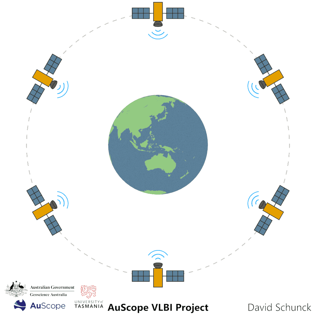
The most important system relying on the measurements and products of the VLBI technique is satellite navigation. In satellite navigation artificial satellites orbiting Earth provide positioning, navigation, and timing information to its users. While the Earth rotates the satellites move around it in their orbits.

The largest sectors depending on satellite navigation include passenger and freight transport, precision agriculture, construction, Earth research, emergency services, and banking and finance. It is estimated that an outage of satellites would cost the US economy alone about one billion dollars per day.
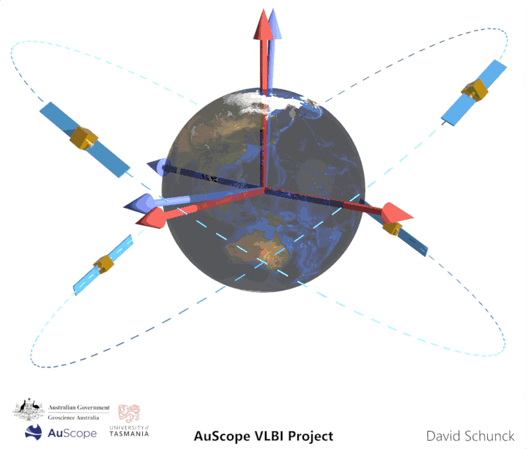
One can only effectively make use of satellite navigation if the satellites’ positions and velocities can be described in a reference coordinate system that moves with the Earth’s rotation (blue). Satellite orbits are affected by disturbing forces, such as the gravitational pull of the Earth, Moon, and Sun, as well as radiation pressure. Due to dynamic processes within its core, the Earth’s rotation axis and angular rate are not constant. They vary over time, making the Earth wobble in space. The relative movement of both systems can only be disentangled when defining another reference coordinate system which is stable with respect to the universe (red).
The blue reference coordinate system is the International Terrestrial Reference Frame (ITRF).
The red reference coordinate system is the International Celestial Reference Frame (ICRF).
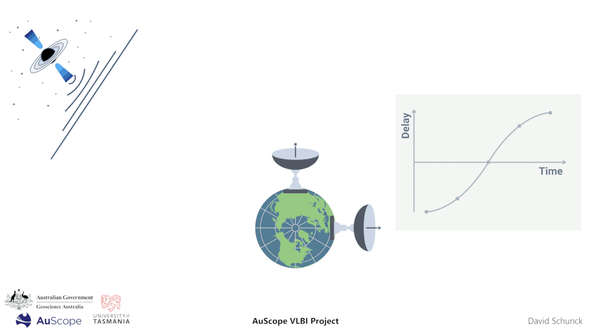
In VLBI, radio telescopes on the Earth’s surface observe extragalactic radio sources that are stable in the universe. The telescopes track these sources and measure the difference in the signal arrival times between them, the so-called delay. The change in delay over time contains information that allows us to establish a link between the Earth and the universe.
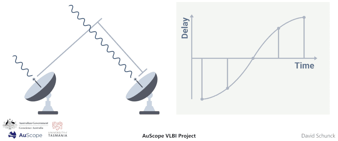
The amplitude of this delay change provides information about the distance between the two telescopes. VLBI measurements allow us to determine the distance of radio telescopes over thousands of kilometres with a precision of just a few millimetres. By combining multiple baselines, a global network is formed. From this, a reference coordinate system that moves with the Earth’s rotation can be derived, the ITRF.
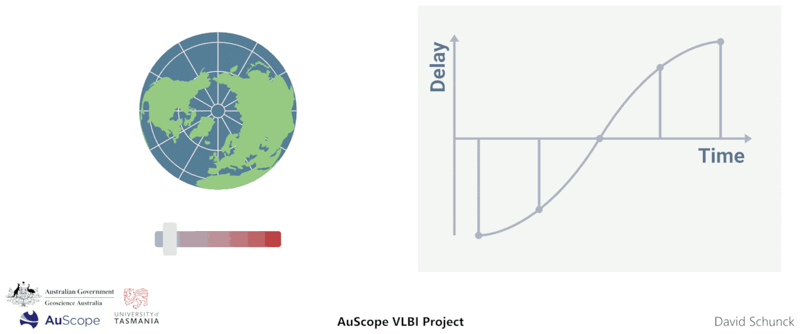
The change in delay over time is also sensitive to changes in the Earth’s rotation. If the Earth’s rotation speeds up, the delay changes more quickly. This allows us to describe the Earth’s motion with respect to the universe. The Earth’s rotation axis and rate can be described with the so-called Earth orientation parameters (EOP). The Earth orientation data links the ITRF to the ICRF.
This experimental AuScope science communication project was conducted in collaboration with Geoscience Australia and the University of Tasmania (UTAS).
It has been designed, created and produced by Dr David Schunck and Dr Lucia McCallum from the geodetic VLBI research group at the University of Tasmania.
All graphics and animations on this website may be used freely for educational and non-commercial purposes with appropriate attribution.